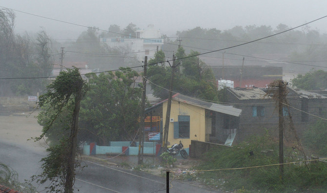
ISLAMABAD: Biparjoy, a very severe cyclonic storm that developed into the Arabian Sea last week, crossed India’s Gujarat coast and adjoining Pakistan-India border late Thursday, the Pakistan Meteorological Department (PMD) said on Friday, weakening in intensity after a landfall near India’s Jakhau town.
More than 180,000 people were evacuated in India and Pakistan in the last few days as authorities braced for Biparjoy, meaning ‘disaster’ or ‘calamity’ in the Bengali language, to hit coasts in both countries. The very severe cyclonic storm made a landfall near Jakhau, a port in Gujarat that is close to the border with Pakistan, weather officials said, blowing off roofs of houses and uprooting trees in the western Indian state.
In Pakistan, the cyclone largely spared coastal areas in the southern Sindh province, with people staying in temporary shelters in the coastal districts expected to start returning to their homes on Friday. However, widespread rain-thunderstorm with some heavy to very heavy falls were likely in Thatta, Sujawal, Badin, Tharparker, Mirpurkhas, Umerkot, Karachi, Hyderabad, Tando Muhammad Khan, Tando Allayar, Shaheed Benazirabad and Sanghar districts till June 17, according to the PMD.
“The Very Severe Cyclonic Storm (VSCS) “BIPARJOY” over northeast Arabian Sea after crossing the Indian Gujarat coast (near Jakhau port) has weakened into a Severe Cyclonic Storm (SCS) and lies near Latitude 23.8°N & Longitude 69.4°E at a distance of 200km east-southeast of Keti Bandar, 180km southeast of Thatta & 270km east of Karachi,” the PMD said in a weather updated at 9am on Friday.

The screen grab, taken from Zoom Earth, shows the current position of tropical Cyclone Biparjoy at 9:30 (PST) in the Indian state of Gujarat on June 16, 2023. (Photo courtesy: Zoom Earth)
“The associated maximum sustained surface winds are 80-100 Km/hour. Very rough sea conditions over Northeast Arabian Sea prevail with wave height 10-12 feet. The system is likely to weaken further into a Cyclonic Storm (CS) by today noon and subsequently into a Depression by today evening.”
The PMD said sea conditions along the Sindh-Makran coast were likely to remain rough with up to 2-meter-high tides, advising fishermen not to venture in open sea until the system was over by June 17.
“Squally winds may cause damage to loose & vulnerable structures (Kutcha houses) in Thatta, Sujawal, Badin, Tharparker and Umerkot districts,” it added.
Biparjoy developed into a cyclone in the early morning hours of June 6. According to Roxy Mathew Koll, a climate scientist at the Indian Institute of Tropical Meteorology, sea surface temperatures in the Arabian Sea were 31°C to 32°C in early June, which was 2°C to 4°C above the climatological mean.
A rule of thumb among scientists is that ocean temperatures should be above 27°C to sustain a tropical cyclone, according to NASA. Unusually warm waters helped fuel Biparjoy’s rapid intensification twice in its lifetime.
Between June 6 and 7, Biparjoy’s wind speed increased from 55 to 139 kilometers per hour (34 to 86 miles per hour), according to the Joint Typhoon Warning Center (JTWC). The cyclone intensified again between June 9 and 10, when its wind speed increased from 120 to 196 kilometers per hour (75 to 122 miles per hour), making it a category 3 storm. Warm sea surface temperatures contributed to the cyclone’s unusually long lifespan.
Cyclones in the Arabian Sea are relatively rare, although they are becoming more frequent with rising sea surface temperatures. A 2021 study led by researchers in India found that cyclones over the last four decades had become more frequent and lasted longer. The researchers found that ocean temperatures were linked to this change.


